

ODC sign XMAP Cloud GIS reseller agreement
Geoxphere are pleased to announce Oxford Data Consultancy (ODCGIS) as reseller of XMAP, our cloud-based GIS platform. ODCGIS will be offering XMAP as a cost-effective and modern way for their housing ...

Surrey Heath Improves Public Engagement with XMAP Mapping Portal
Surrey Heath Borough Council, UK, has launched a new interactive mapping portal for public consultation on its Draft Local Plan.

New Energy Performance Data in XMAP Helps Councils Tackle Climate Change
XMAP, the local government geographic information system (GIS), now includes ratings of property energy performance to help Council’s tackle climate change, improve housing standards and ensure privat...

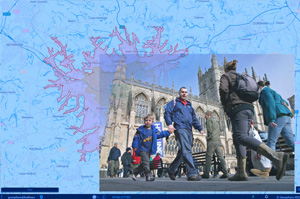
XMAP Cloud GIS Joins-Up Service Delivery for South Somerset Ahead of Unitary Change
South Somerset District Council (SSDC) has deployed XMAP, the new generation Geographic Information System (GIS) platform, to join-up service delivery, engage with communities and develop stronger rel...
Isochrone Tool Launched to Support Government’s £2 Billion Active Travel Pledge
XMAP, the local government geographic information system (GIS) service from Geoxphere, now offers a smart, green transport module to help local councils promote Active Travel and secure funding from t...

XMAP Cloud GIS Brings Government Flexible Working Closer to Home
XMAP, the local government geographical information system (GIS), has been developed to underpin the UK government’s latest proposals for flexible working.
Most Read
- New Energy Performance Data in XMAP Helps Councils Tackle Climate Change
- XMAP Cloud GIS Joins-Up Service Delivery for South Somerset Ahead of Unitary Change
- Surrey Heath Improves Public Engagement with XMAP Mapping Portal
- XMAP Cloud GIS Brings Government Flexible Working Closer to Home
- Isochrone Tool Launched to Support Government’s £2 Billion Active Travel Pledge