
subscription to a continuously updated catalogue of oblique aerial imagery
Overview
The Oblique module for XMAP Cloud GIS give you and your colleagues an intuitive and engaging view of the urban environment.
Use the built-in fascade and height measurement tools to extract detailed and accurate measurements; perfect for remotely analysing a scene for planning, construction, transport or taxation purposes.
The Oblique module is available directly in your XMAP account, or through our trusted partners who capture and upload oblique imagery for you.
Service Benefits
- Intuitive view of the urban environment
- Reduce site visits
- Informed decision-making
- Better communication of ideas
- Protect against claims
Oblique imagery makes it easy to understand complex environments by offering a true-to-life view that top-down aerial photography and mapping cannot do alone.
There are even less reasons to make that car journey. This makes your team more productive with less ‘down-time’ driving and a huge reduction in costs and CO2 emissions.
Having access to time-stamped imagery gives staff increased confidence in decision-making. Being sure of when changes were made allows staff to plan ahead, provide accurate information to the public or customers, and conduct meaningful assessments of how the environment has changed.
Sharing oblique imagery is a great way to engage a client or colleague with your ideas. There’s no interpretation of GIS data, it’s exactly as you see it.
The oblique imagery can be used if claims against your organisation are made. Having time-stamped evidential data to support claims cases can have a vast reduction in fraudulent claims being approved.
Service Features
- Intuitive birds-eye view
- Side-by-side views
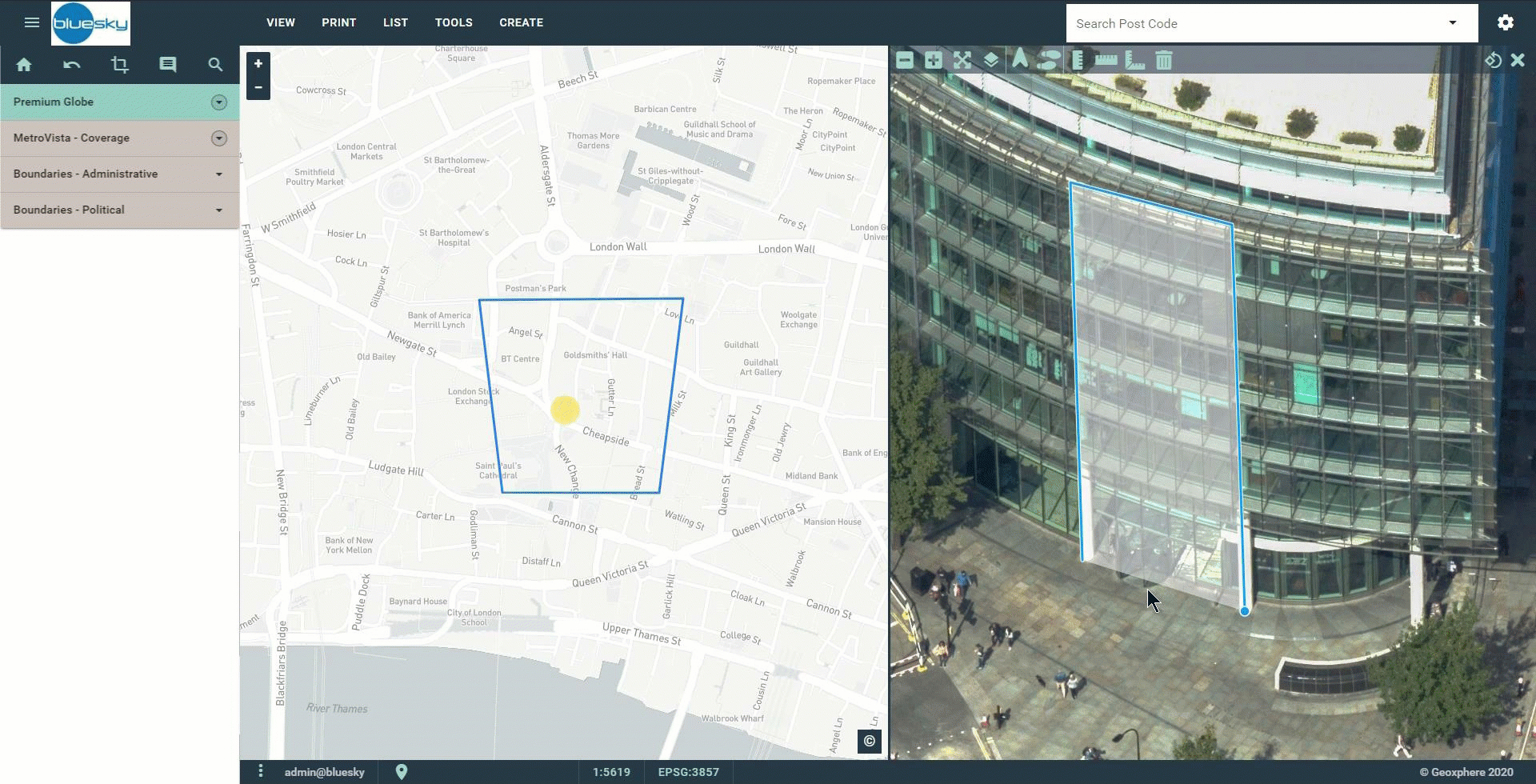
- Vertical and Facade measurements
- View from all 4 angles
- No browser plugins
Use oblique imagery to see more detail of the built environment than you would with a 2D map or aerial photography. This view helps users of GIS to better understanding of the area with an intuitive birds-eye view.
Choose between vertical or horizontal split-screen views
Measure height and area features in the oblique view
Rotate around a building or object to see it from all 4 angles. This gives you a better chance of seeing the detail you need.
No plugins or special settings required. Use the tool in your web browser on desktop or tablet.
Data Features
Depending on the reseller or XMAP partner you use, you may be able to get access to their complete oblique archive at no extra cost. So you simply pay your subscription and always receive updates.
With a subscription to this addon there's no need for local copies of the data. Let us manage the hosting of terabytes of oblique aerial imagery.
Browse Other Cloud GIS Addons
Regional Providers
We've partnered with trusted companies around the World to sell their oblique data as a subscription service within XMAP Cloud GIS.
Contact them directly or speak to us and we'll find the best solution for you.
Contact them directly or speak to us and we'll find the best solution for you.