

Mid Sussex District Council use XMAP as their corporate GIS
Overview
Mid Sussex District Council adopted XMAP when looking to replace their existing on-premise corporate GIS system that was getting a bit long in the tooth. XMAP was chosen through a competitive tender process and was chosen on its competitive price, it's functionality and the benefits gained from having a cloud-based system.
Keith, who only has 25% of his time available to provide GIS support for the whole council, needed a service that essentially took care of itself. He relies on XMAP to continuously evolve and update, meaning he can get on with other parts of his job without wasting time on software or IT hardware maintenance.
XMAP has been used in all areas of the council, including in the reception area where open-access computer display the XMAP Public Map. This means members of the public can view key mapping information in an easy-to-use interface.
Key Wins
- The switch to an "evergreen" GIS service means there's no local IT to contend with, it's all accessible through a web browser.
- Remote working has been and easy transition without worrying about VPNs or office bandwidth.
- Use of GIS expanded to all areas of the council, including in management.
- Reduction of desktop GIS usage, leading to less support, maintenance and cost needed.
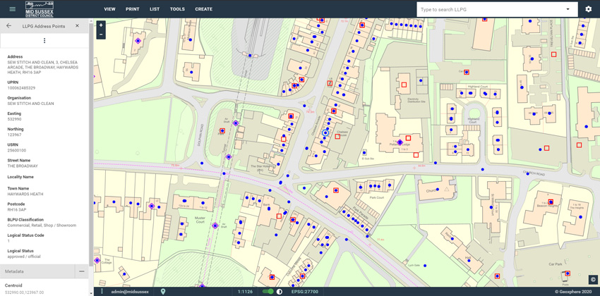
- Seamless integration of LLPG to ensure consistent use of addressing and UPRNs across the council
Key Projects
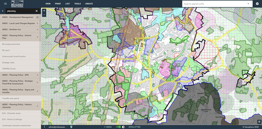
- Digitisation of historic planning records which are loaded into XMAP, giving a comprehensive planning history layer.
- Support of strategic broadband initiatives communicating the plans to the public and stakeholders.
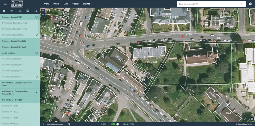
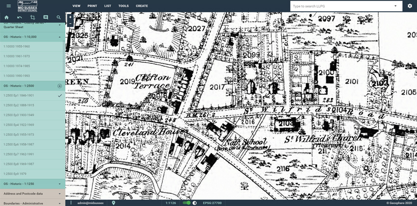
- Loading of historic topographic mapping to support planning through the ages.
- Sharing of mapping data to town and parish councils automatically.
- Publication of Tree Preservation Orders using XMAP Public Map through their website.
- Sharing information during elections to individual political groups controlled, clear and fair way.
Screenshots
Back to Category