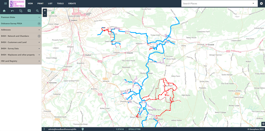
Broadband for Surrey Hills (B4SH) use XMAP to plan, plot and record their fibre network
About B4SH
Broadband for Surrey Hills (B4SH) is a not-for-profit Community Benefit Society, staffed and run by volunteers, providing gigabit fibre-optic broadband to the hard-to-reach areas of the Surrey Hills Area of Outstanding Natural Beauty.
Quote
"B4SH uses XMAP to plan, plot and record its fibre network. The web-based capability of XMAP allows remote-based B4SH volunteers to always have access to the latest network routing information, which saves time and money.
We have been able easily to customise XMAP with its styling capability to display our business-critical information, for example planned and built network, route options, land ownership, different network components and customer location.
XMAP's intuitive user interface makes it very easy for non-GIS experts to use and be productive, and the rapid support from the Geoxphere team has been excellent. I am very happy to recommend XMAP to other community broadband providers."
Angus Denny, Operations Director, B4SH

Technical Info
B4SH take advantage of XMAP's in-build cloud database, meaning they can upload and host their mapping data without having to deal with managing that infrastructure. That's a huge time-saver and allows the B4SH team to get on with their important work without having to learn and maintain database technology.
B4SH also benefit from XMAP's connection to open-source desktop GIS such as QGIS, which allows particularly complex analysis to be conducted on the data without having to download and re-upload data from XMAP's ecosystem.
During the setup of B4SH on the XMAP service, they called upon Geoxphere's network of professionals, including partner company Loose Goat. They helped bring the B4SH network data up to standard so it can be used without any issues.
Back to Category
