
Surrey Heath Borough Council use XMAP with their independent cloud database
Overview
Surrey Heath Borough Council adopted XMAP to completely modernise their GIS and mapping services across the council. They needed something that was cost-effective, intuitive and engaging in order to increase GIS adoption across the council.
The Challenge
GIS information is a critical resource in Local Authorities as it plays a part in all aspects of council operations; from planning to environmental sustainability to customer support. Since the last GIS software was procured, technology, best practices and especially the move towards remote working had changed dramatically. This meant their existing system was no longer fit for purpose and a strategy to migrate to cloud-based services was already under-way.
The challenge, therefore, was to switch to a new GIS service that would meet the expectations of a modern Borough Council and its staff to ensure they could provide efficient and high-quality services for the public.
The Solution
The solution came in the form of the XMAP Suite. This group of services ticked all the boxes for Surrey Heath.
It is fully cloud-based and ‘evergreen’, meaning updates and improvements are applied on a weekly basis to ensure the service always stays up-to-date, secure and feature-rich. It utilises the latest open-source components to ensure communication between other systems is easy and frictionless.
It is provided on an annual subscription basis so there’s no capital investment, no costly consultancy fees and no hidden charges. It means the council can easily budget year-on-year, with no big upgrade costs every few years.
It’s reliable and accessible from any internet-connected device, so the council can adapt to new remote-working situations without being technology-limited. This has the added benefit of ensuring more staff can access the service, making decision-making across the council easier and more consistent.
It was an easy transition to the new system. IT changes can be daunting, but over 80% of the migration was completed in under 2 weeks, with the remainder being finished in another 2.
The Impact
The impact of the switch to this new GIS service has led to a real-term cost saving, a faster and more reliable service, and resilience against traditional locally installed infrastructure and software.
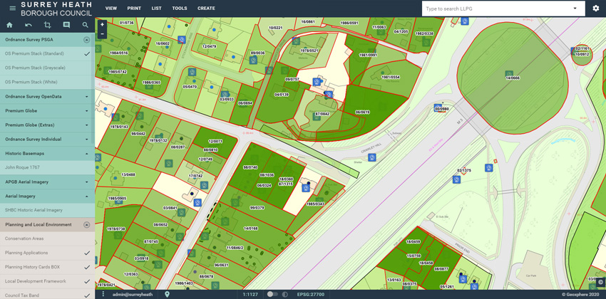
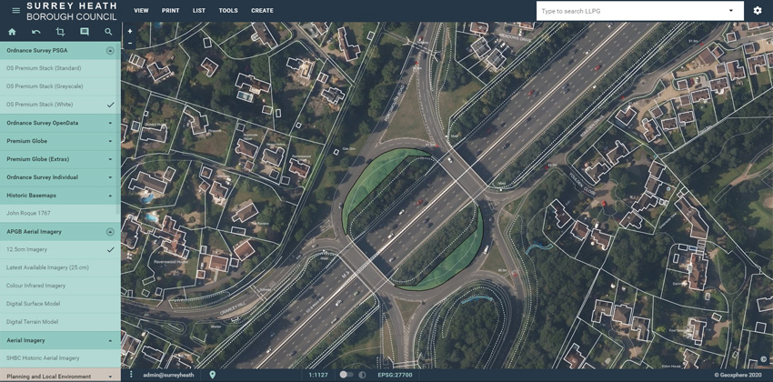
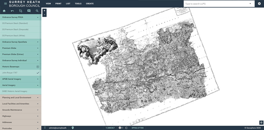
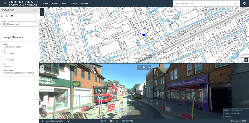
Surrey Heath colleagues can easily access datasets previously difficult to serve such as panoramic imagery, historic aerial photography and mapping and complex planning datasets (see screenshots).
The council have saved £13,000 in software licenses in the first year alone, as well as much more in intangible time saving across the council.
Due to the range of GIS services available in XMAP, the council can now remove old infrastructure and cancel unnecessary licenses of software to achieve even more savings.
Ongoing Learning
Adopting this modern method of delivering GIS data has switched the focus of the GIS/IT team. Maintenance and firefighting used to be the default, but now they’re able to proactively engage in specialist projects to support colleagues, provide training, and look ahead to making council services even more efficient.
With a successful migration to a revolutionary new cloud service, it has proved that the strategy to “off-site” many critical office systems is no longer a risky move, but a sound and necessary step to ensure councils stay efficient and adaptable.
The adoption of XMAP has opened doors for more collaboration between neighbouring local authorities as technology is no longer a barrier. Geoxphere, the company behind XMAP, also operate the Parish Online platform. Our arrangement with Geoxphere means parish councils within the Surrey Heath area gain free access to Parish Online and Surrey Heath can share spatial data such as tree preservation orders and grounds maintenance and grass cutting information with them.
Key Wins
- Simple migration process from previous supplier
- Ultra-fast download times, making it a much nicer experience for users to use maps
- WMS and WMTS of Ordnance Survey mapping integrated with back-office systems
- Easy to use configuration tools for GIS administrators
- Meaningful use of LLPG and UPRNs in GIS for better linking of council systems and data
- Happier users!
Key Projects
- Hosting of archive aerial photography and OS mapping, removing need for local copies
- Reducing local IT infrastructure and utilising evergreen cloud services
- Implementing live data sharing with neighbouring councils, including Town and Parish Councils
Screenshots
Back to Category
Client