


advanced street-view service for visual asset inspections
Overview
XMAP 360 is a software and survey service that brings up-to-date street-level imagery into your GIS view.
The data is captured at a frequency defined by you, so you and your colleagues can rely on fresh panoramic iamgery of your area to assist with all areas of business.
The data is captured at a frequency defined by you, so you and your colleagues can rely on fresh panoramic iamgery of your area to assist with all areas of business.
Service Benefits
Reduced Travel
Be more productive with less ‘down-time’ driving and a huge reduction in costs and CO2 emissions.
Emergency Response
Subscribe to the service on a project basis to perform rapid data capture to support in the aftermath of natural disasters.
Informed Decisions
Time-stamped imagery gives staff increased confidence in decision-making and conduct meaningful assessments .
Safety Inspections
Keep towns and cities safe by rapidly assessing the street scene for issues.
Claims Validation
Time-stamped data protects your organisation against fraudulent claims. Use as an evidential record.
Historic Reference
Capturing regular surveys of a city, estate or monument gives a valuable historic record to refer to.
All Local Authority departments can use XMAP, so with no user or usage limit everyone can benefit from the time-saving technology.
Service Features
Choose between different views when interacting with the imagery.
The split screen view gives the viewer both map-based and imagery information. The full screen view lets the viewer focus on the imagery.
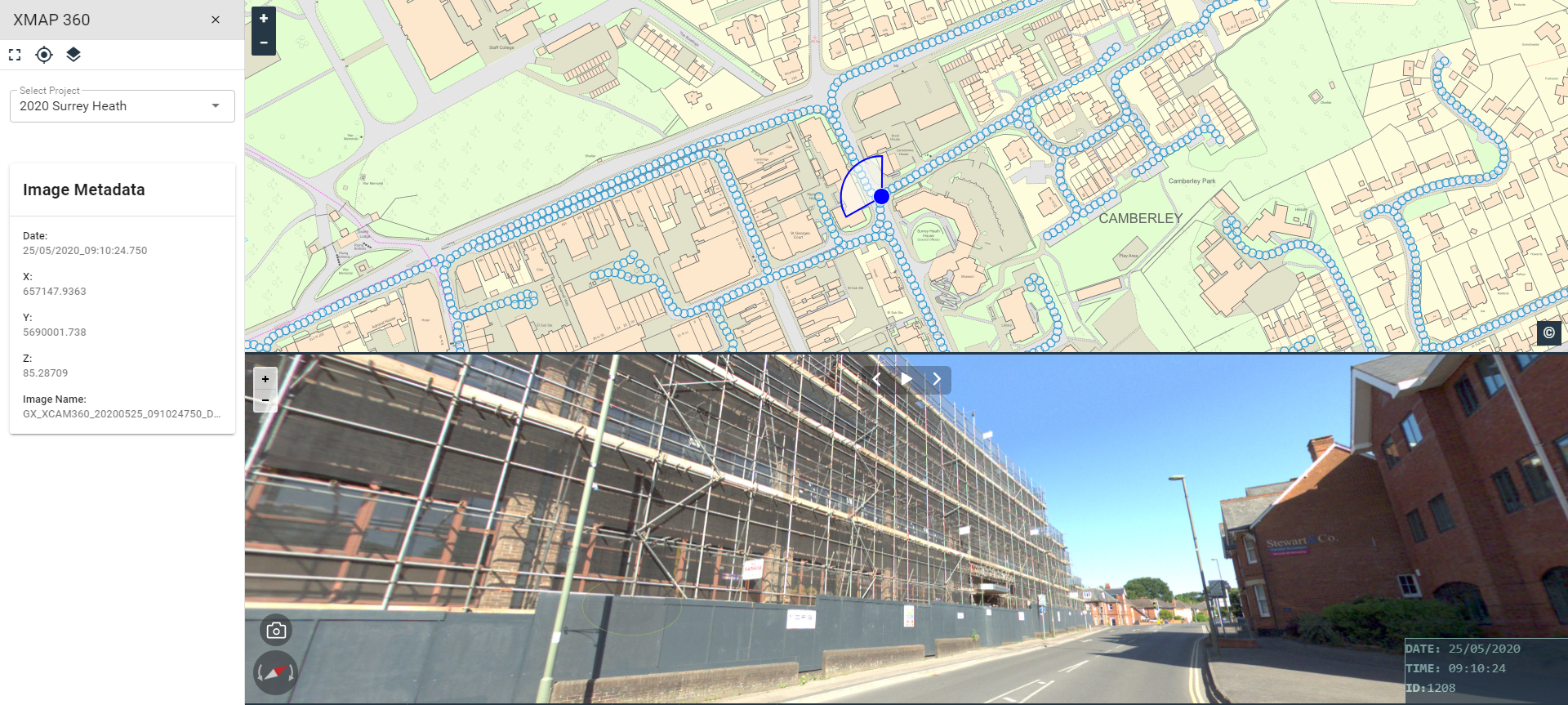
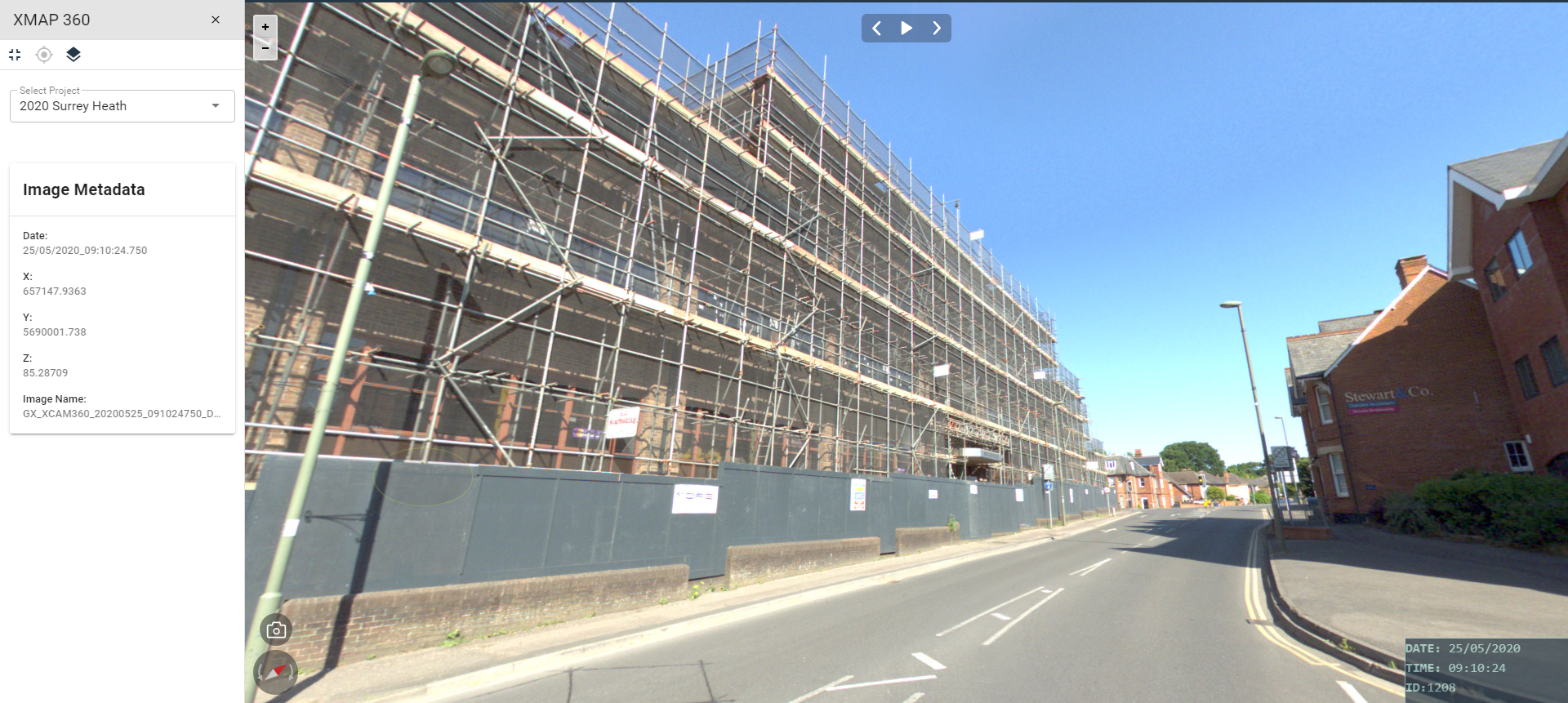
The split screen view gives the viewer both map-based and imagery information. The full screen view lets the viewer focus on the imagery.
XMAP 360 module can be enabled for all XMAP Cloud GIS users with a single click, giving an increased value for money per user.
The 360 addon does not require any plugins, flash or any special settings in the web browser to work.
Data Features
Street imagery can be a huge amount of data. All hosting and processing is managed by Geoxphere. This makes the service a predictable and manageable cost.
Provisioning mobile mapping data is a minefield with so many suppliers offering a wide range of services at different specification levels with LiDAR point clouds and all sorts of unnecessary addons.
Geoxphere captures data that’s fit-for-purpose and fully compatible with our 360 viewer (obviously!). This gives peace of mind that there’ll be no compatibility issues when subscribing to the service.
Geoxphere captures data that’s fit-for-purpose and fully compatible with our 360 viewer (obviously!). This gives peace of mind that there’ll be no compatibility issues when subscribing to the service.
The imagery we provide is not software-locked or in a proprietary format, so doing additional analysis work or porting the data to a different solution will be hassle-free.
Geoxphere can import panoramic imagery from other suppliers into the XMAP 360 addon. The viewer supports any data where a non-levelled equirectangular image with corresponding positional and orientation information is provided.
Examples include Trimble XM7, Trimble MX9 and Leica Pegasus.
Examples include Trimble XM7, Trimble MX9 and Leica Pegasus.
Pricing
XMAP 360 services are offered as a subscription service or one-off surveys.
We have a range of pricing models and offer flexibility to make sure our services are great value for money.
We have a range of pricing models and offer flexibility to make sure our services are great value for money.
UK Local Government
G-Cloud
- Verified G-Cloud framework service
- No tender process necessary
- Setup in less than a day
- Multi-year discounts
Commercial & Government
£2000per year
- From £2,000 per year
- Pricing scaled by frequency and area
- Quarterly or annual payment options
- Multi-year discounts
Bespoke
POA
- For private sites, secure establishments and international projects
- Deployment anywhere in the world, including responsive humanitarian projects
Not sure what to choose? Don't worry, get in touch and we can find a model that's right for you.